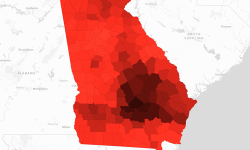
+Indicator Methodology
The Annual Number of Tornadoes is calculated by collating historical tornado data provided by the National Oceanic and Atmospheric Administration National Weather Service Storm Prediction Center (SPC) (https://www.spc.noaa.gov/ ). This data encompasses detailed records of each tornado, including its path, date and time of occurrence, width, intensity rating based on the Enhanced Fujita Scale, and associated injuries and fatalities. Tornado impact areas are estimated by spatially buffering the geographic path of each tornado by half of its reported width to create polygons. These polygons are then overlaid with county, census tract boundaries to determine which jurisdictions have been affected. A jurisdiction is counted as affected if any part of the tornado impact area intersects with its boundary. The annual total of tornadoes, classified by their EF-scale ratings from EF-0 to EF-5, is tallied for each affected jurisdiction, giving a count of the number of tornadoes that occurred each year.
This calculation method is provided by the CDC National Environmental Public Health Tracking (https://ephtracking.cdc.gov/indicatorPages )


